Tidal Datum Conversion example
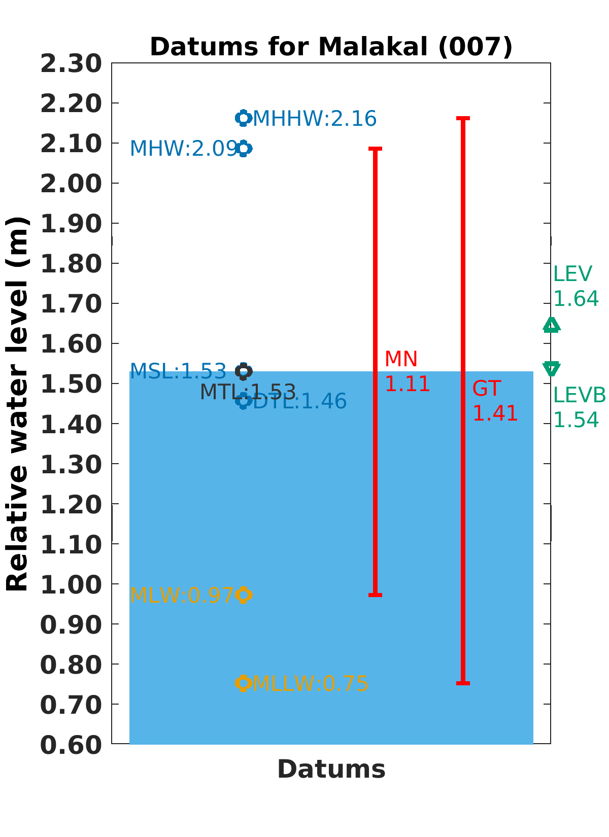
Let's take the Malakal-B station in the Republic of Palau as an example. The values provided for this station allow us to convert between different tidal datums.
The values for Mean Higher High Water (MHHW) and Mean Lower Low Water (MLLW) at the Malakal-B station are 2.162 meters and 0.753 meters respectively, both relative to the station datum. The Mean Sea Level (MSL) at this station is 1.532 meters.
To convert the MHHW and MLLW values to be relative to MSL, you would subtract the MSL value from the MHHW and MLLW values. Here's how:
- MHHW relative to MSL: 2.162m (MHHW) - 1.532m (MSL) = 0.630m. This means the Mean Higher High Water is 0.630m above the Mean Sea Level.
- MLLW relative to MSL: 0.753m (MLLW) - 1.532m (MSL) = -0.779m. This means the Mean Lower Low Water is 0.779m below the Mean Sea Level.
- To convert tide gauge water level observations to be with respect to MSL, you would subtract the MSL value from the observed water level value.
Remember, this example is specific to the Malakal-B station based on the values provided. The specific values and therefore the calculations would be different for other stations. It's important to use the correct values for the station you're interested in. The metadata provided about the tide gauge station, such as its geographical coordinates and the instrument types used, can also provide useful context for interpreting the data.